Assessment & design of large-scale water conservation projects in natural protected areas of Mexico
Research funded by the National Geographic Society (NGS-72450C-20)
Research funded by the National Geographic Society (NGS-72450C-20)
During 2022-2023, Drs. Matthew LaFevor (University of Alabama) and Carlos E. Ramos-Scharrón (University of Texas at Austin) carried out fieldwork in Mexico’s Pico de Orizaba National Park and Natural Protected Area (Fig.1). The fieldwork was funded by a grant from the National Geographic Society (NGS-72450C-20) and examined water conservation projects in alipne environments. The research goal was to determine if a common form of water harvesting structures known as tinas ciegas (infiltration trenches) was effective at gathering runoff and helping it infiltrate into the subsoil.
Figure 1. Natural Protected Areas (NPAs) along Mexico's trans-volcanic axis with Pico de Orizaba NPA highlighted.
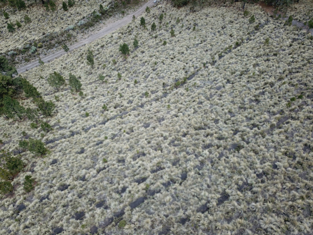
The tinas ciegas trenches resemble simple cut-and-fill earthworks. Typically, each is excavated (cut) perpendicular to the hillslope with the excavated soil (fill) placed immediately downslope. Individually, each trench is about the size of a bathtub. Expansive fields of trenches now occupy landscapes in some of Mexico's largest alpine natural protected areas. Collectively, the fields of trenches are known as fábricas de agua (water factories) for how they are supposed to "produce" or increase surface water harvesting, retention, and infiltration. Ultimately, the fábricas are assumed to enhance water supply for ecosystems and human consumption (Fig.2).
Figure 2. Oblique aerial view of infiltration trenches in the Pico de Orizaba National Parka and Protected Area (photo by Dr. LaFevor).
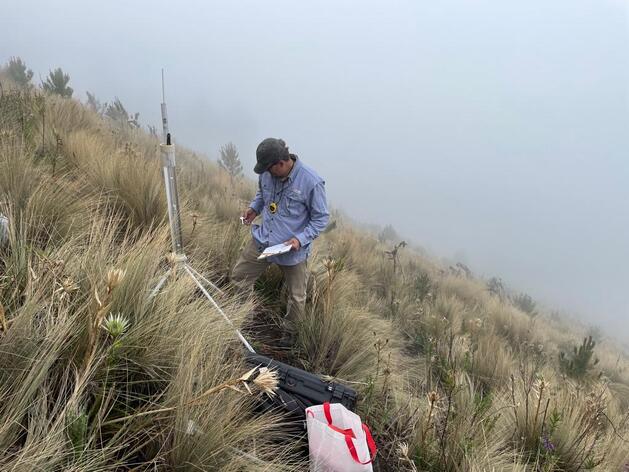
To examine whether the fábricas are effective, the team used a methodology similar to that used in their previous study in the Matlalcueyetl (Malinche) Natural Park and Protected Area where a similar earthwork was examined (LaFevor and Ramos-Scharrón, 2021). In both field projects a Guelph permeameter was used to estimate the saturated hydraulic conductivity (Ksat) and infiltration capacities of both natural (undisturbed) and trenched soils (Fig. 3).
Figure 3. Dr. LaFevor estimates Ksat of trenched soils using a Guelph permeameter at the Cerro Colorado site (photo by Dr. Ramos-Scharrón, video by Dr. LaFevor)
An aerial drone (UAV) was used to map field sites and create high-resolution digital elevation models (DEMs). Seven sites were chosen for mapping and hydrologic characterization (Fig.4). The results were combined with existing climatic data and modeled, again following LaFevor and Ramos-Scharrón (2021), to determine if the trenches provided greater infiltration of runoff than on the adjacent, undisturbed hillslopes.
Figure 4. a) Map of the seven fieldsites highlighting Cerro Colorado site (#1), b) orthomosaic image of Cerro Colorado site created from orthophotographs taken with aerial drone, c) map of 255 georeferenced photos used to create images and models, and d) digital elevation model (DEM) of fieldsite at ~5cm/px resolution.
Preliminary results suggest that trenched sites in the Pico de Orizaba National Park and Protected Area provide negligible benefits to water conservation. In other words, most trenches do little to enhance surface water retention or infiltration over undisturbed or baseline conditions. Additional details and findings are being summarized in manuscripts for publication and in instructional materials for use in future trenching efforts and in the classroom.
For inquiries, contact Dr. LaFevor ([email protected]).
For inquiries, contact Dr. LaFevor ([email protected]).


